MENU
.png)
.png)

_2472x1410_edited.jpg)
India’s Most Advanced Drone Fleet for Emergency Response
When disaster strikes, every moment is critical. Laputa’s Disaster Response Drone Service delivers cutting-edge drones equipped with thermal imaging, AI-powered analytics, and high-payload capabilities — all backed by DGCA-compliant operations. From earthquake aftermath to flood rescues, our drones are built for impact.

Thermal Imaging — Detect human heat signatures instantly.

Real-Time Data — Live aerial feed and situational awareness.

Autonomous Flights — Navigate dangerous zones without pilots.
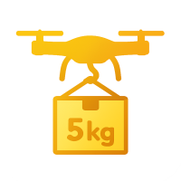
Payload Capacity — Carry up to 5 kg of critical supplies.

Rugged Design — Operate in rain, dust, or high winds.

Where We Fly In to Help

Damage Assessment
High-resolution aerial imagery captures an up-to-date mosaic of the affected area, revealing collapsed buildings, flooded roads, and impassable bridges. Automated algorithms stitch and analyze these images to generate detailed damage maps, highlighting priority zones for relief and repair. By delivering actionable insights within hours, planners can deploy resources strategically and avoid redundant efforts.
.png)
Rescue Supply Delivery
Fixed-wing and multirotor drones ferry essential food, medicines, blood units, and vaccines directly to disaster affected areas, isolated villages and mountainous hamlets. Flying above crumbled roads and swollen rivers, they shrink delivery times from days to under an hour, preserving the cold chain for sensitive pharmaceuticals. This rapid last-mile service ensures that critical treatments reach patients before conditions worsen.
.png)
Emergency Communication
When terrestrial networks fail, swarms of tethered and free-flying drones form a temporary aerial mesh, relaying voice, text, and data signals across darkened regions. Each node in the sky extends coverage by hopping traffic between its neighbors, restoring connectivity even in the most devastated zones. Aid coordinators and survivors alike regain the ability to call for help, share situational updates, and direct relief operations.

Search & Rescue
Drones equipped with thermal cameras sweep unstable structures, penetrating smoke and debris to pinpoint heat signatures of trapped individuals. The real-time feed guides ground teams directly to the most critical spots, cutting search times from hours to minutes. This rapid localization not only boosts survival rates but also reduces risk for rescue personnel.

Search & Rescue
Detect trapped survivors using thermal vision.

Damage Assessment
Map disaster zones for tactical
planning.

Medical Supply Delivery
Reach remote or cut-off regions
fast.

Emergency Communication
Set up aerial mesh networks in power blackouts
5 Steps to Save Lives with Laputa’s Drones
.png)
.png)
01
1. Deployment
Mobilize drone units within hours to disaster zones.
-
Our response-ready teams activate within hours
-
Location-based dispatch for fast access
-
Preloaded mission presets for different disaster types
2. Data Collection
Capture high-resolution aerial imagery and real-time thermal scans.
-
Drones fly over affected zones with 4K cameras
-
Thermal and multispectral sensors detect heat signatures
-
Real-time streaming to command center

02
.png)
03
3. AI Analysis
Detect survivors, blocked routes, and infrastructure damage.
-
Built-in AI identifies humans, vehicles, and debris
-
Prioritizes rescue zones using heatmap overlays
-
Classifies risk zones for planning and action
.png)
04
4. Coordination
Instantly share insights with government or NGO partners.
-
API-ready dashboards for multi-agency viewing
-
Secure cloud storage with real-time access
-
Enables synced rescue efforts across stakeholders
.png)
05
5. Reporting
Receive detailed post-mission reports with visuals and stats.
-
PDF reports with time-stamped visuals and GPS data
-
Damage heatmaps and survivor locations
-
Archive-ready for audits, funding, and analysis
Understand Your Vision: We start by learning your event goals, venue layout, and the kind of visual story you want to create — romantic, brand-focused, or national celebration. This step ensures your aerial show fits perfectly with your theme and audience.

STEP 1
Deployment

STEP 2
Data Collection

STEP 3
AI Analysis

STEP 4
Coordination

STEP 5
Reporting
Mobilize drone units within hours to disaster zones.
-
Our response-ready teams activate within hours
-
Location-based dispatch for fast access
-
Preloaded mission presets for different disaster types
Capture high-resolution aerial imagery and real-time thermal scans.
-
Drones fly over affected zones with 4K cameras
-
Thermal and multispectral sensors detect heat signatures
-
Real-time streaming to command center
Detect survivors, blocked routes, and infrastructure damage.
-
Built-in AI identifies humans, vehicles, and debris
-
Prioritizes rescue zones using heatmap overlays
-
Classifies risk zones for planning and action
Instantly share insights with government or NGO partners.
-
API-ready dashboards for multi-agency viewing
-
Secure cloud storage with real-time access
-
Enables synced rescue efforts across stakeholders
Receive detailed post-mission reports with visuals and stats.
-
PDF reports with time-stamped visuals and GPS data
-
Damage heatmaps and survivor locations
-
Archive-ready for audits, funding, and analysis


The Smartest, Safest, and Fastest Response Solution


Faster Response – Drones reach areas manned teams can't.
Human Safety First – Keep responders away from danger.
Better Coordination – Share live insights across agencies.
Cost Savings – Replace helicopters and reduce manpower.
Versatility – Ready for floods, fires, quakes, and more.
Trusted by India’s Emergency Leaders
Real stories. Real results. Real impact.
"Laputa’s drones saved lives during our flood relief efforts."
Arun Kumar
Director, NGO Chennai
"Their thermal imaging found survivors in hours."
Meena Nair
Emergency Coordinator, Mumbai
"Laputa transformed our wildfire response planning."
Vijay Desai
Government Official, Delhi
"The drone dropped 6kg of supplies on a rooftop where two families were stranded. Unbelievable precision."
Farida Sheikh
Rescue Officer, Assam

ISO 9001:2015

FAA-Approved Systems

BIS-Certified Tech Partners

4.9/5 rating from 3,200+ verified users
