_2406x1418_edited.jpg)
Revolutionize Construction with Laputa Drones
Faster surveys. Safer sites. Smarter decisions.
Deploy next-gen drone intelligence on your construction projects now.

Built for Builders. Engineered for Tomorrow.
Construction is tough—deadlines are tight, margins are thin, and safety is non-negotiable. Laputa brings a powerful aerial solution directly to your site.
Using advanced tools like LiDAR, high-definition imaging, and AI analytics, we help you monitor, measure, and manage every phase of your project faster and smarter than traditional methods. This means accurate progress tracking, fewer costly re-surveys, and maximized safety.
We're proud to be at the forefront of this technology—our solutions are fully DGCA, ISO, and BIS-certified. You get world-class safety and compliance, whether your project is in a major city or a remote rural landscape.

Centimeter-level LiDAR mapping

HD aerial progress tracking

AI insights for better planning

Thermal imaging for safety checks

3D site modeling in minutes

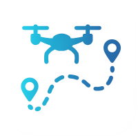
Where Our Drones Work Best

Site Surveying
Drones capture overlapping high-resolution images or LiDAR scans across the site to generate orthomosaics and digital terrain models. These outputs deliver sub-5 cm accuracy contour maps and DSM/DTM files ready for CAD or GIS import. As a result, you reduce weeks of manual surveying to hours while cutting field costs by up to 75%.

Progress Monitoring
Drones fly scheduled missions to gather aerial orthomosaics and 3D snapshots that show “as-built” progress. You can overlay these captures onto your design model or compare against previous surveys to spot schedule deviations and material bottlenecks. Automated cloud platforms then flag anomalies, letting you adjust resources before delays escalate.

Volumetric Calculations
High-accuracy point clouds from photogrammetry or LiDAR yield dense surface meshes that calculate cut/fill volumes instantly. Sequential surveys track stockpile changes or excavation progress with centimeter-level precision. Exportable volume reports integrate into ERP or earthworks software for streamlined logistics and billing.

Safety Inspections:
Using zoom-capable gimbals and thermal sensors, drones inspect welds, electrical cabinets, and structural elements from safe distances. They detect cracks, corrosion, and hot spots without putting personnel at height or risk. AI analytics then prioritize and tag hazards so safety teams can tackle the most urgent issues first.

Site Surveying
Accurate topographical maps
for planning

Progress Monitoring
Monitor worksite milestones in
real-time

Safety Inspections
Identify structural or hazard risks
remotely

Volumetric Calculations
Patriotic symbols, tricolor waves, or portraits of heroes.
From Site Plan to Aerial Intelligence – It’s Simple
.png)
.png)
01
1. Consultation
Project Discovery & Planning: We begin by understanding your project's scope, location, timelines, and goals. Our experts will work with your engineers and planners to define objectives and identify how drones can streamline your construction workflow.
.png)
02
2. Drone Strategy Design
Flight Path & Sensor Blueprint: Our team creates a custom aerial strategy defining flight paths, selecting the right sensors (LiDAR, thermal, HD camera), and configuring AI parameters based on your terrain, safety zones, and reporting needs.
.png)
03
3. Data Capture
Precision Aerial Scanning: Certified DGCA-licensed pilots deploy our high-tech drones on-site. They collect real-time aerial data using pre-mapped routes, ensuring centimeter-level accuracy and complete visual coverage of the area.
.png)
04
4. AI Modeling & Reports
Smart Analytics & Visual Reports: Captured data is processed using AI and advanced modeling tools to generate 3D site models, Ortho mosaics, heat maps, and volumetric calculations, giving your team powerful visual intelligence.
.png)
05
5. Ongoing Monitoring
Continuous Project Oversight: Need recurring scans? We offer scheduled drone visits for construction tracking, safety compliance checks, and stakeholder updates, keeping your site secure and always on course.
Understand Your Vision: We start by learning your event goals, venue layout, and the kind of visual story you want to create — romantic, brand-focused, or national celebration. This step ensures your aerial show fits perfectly with your theme and audience.

STEP 1
Consultation
STEP 2
Drone Strategy Design

STEP 3
Data Capture

STEP 4
AI Modeling & Reports

STEP 5
Ongoing Monitoring
We begin by understanding your project's scope, location, timelines, and goals. Our experts will work with your engineers and planners to define objectives and identify how drones can streamline your construction workflow.
Our team creates a custom aerial strategy — defining flight paths, selecting the right sensors (LiDAR, thermal, HD camera), and configuring AI parameters based on your terrain, safety zones, and reporting needs.
Certified DGCA-licensed pilots deploy our high-tech drones on-site. They collect real-time aerial data using pre-mapped routes, ensuring centimeter-level accuracy and complete visual coverage of the area.
Captured data is processed using AI and advanced modeling tools to generate 3D site models, orthomosaics, heat maps, and volumetric calculations—giving your team powerful visual intelligence.
Need recurring scans? We offer scheduled drone visits for construction tracking, safety compliance checks, and stakeholder updates—keeping your site secure and always on course.


Why Builders Choose Laputa Construction Drones

70% Faster surveying vs. manual
Centimeter-Level Accuracy = less rework
Worker Safety First – no risky inspections
Save Millions in material + labor inefficiencies
Easy Sharing – 3D visuals for team & clients
What India’s Top Builders Are Saying
Real stories. Real results. Real impact.
"Laputa’s drones cut our survey time by half. We saved millions on man-hours and rework. Their team is fast, reliable, and future-ready."
Project Manager, Mega Infra Ltd, Mumbai
"The 3D terrain models and heat maps from Laputa gave us pin-point accuracy. Our designs now align better with real ground conditions."
Chief Architect, Skyline Designs, Delhi
"Their aerial inspections helped us identify structural issues early and pass every safety and compliance audit without delays."
Lead Contractor, BuildCon India, Bangalore
"Laputa’s AI-powered drone intelligence is now a non-negotiable part of our QA process. It’s like having a digital engineer in the sky."
Civil Engineering Consultant, Chennai

ISO 9001:2015

FAA-Approved Systems

BIS-Certified Tech Partners

4.9/5 rating from 3,200+ verified users
Ready to Light Up Your Event?
Let’s Design Your Sky Strategy, Chat or call with Us , Tell us your Ideas

MENU
.png)
.png)
